Zarzęcin demo site
Charakterystyka obszaru
A bay including an adjacent valley of a periodical stream in the village of Zarzęcin is an example of the site where measures aiming to reduce diffused pollution inflowing from heavily built-up area with ground and surface waters shall be implemented.

| Owner - | share: 1/1 STATE TREASURY; Managing Authority: RBWM in Warsaw |
| Plot number | ½? |
| Voivodship | Łódzkie |
| District | Piotrkowski |
| Municipality | Wolbórz |
| Village | Zarzęcin |
| Cadastral Unit | 100703_2 Mniszków |
| Section | No. 0029, Zarzęcin |
General Characteristics
Zarzęcin demo site is situated in a very clear erosion-sensitive formation, i.e. in a V-shaped valley, which carries water periodically following intensive precipitation and during snow-melt. A permanent seepage has also been observed during monitoring activity delivered under Action A.2.2.
This demo site is located in the south-eastern section of Sulejów Reservoir thus it is situated in the oldest relief within the incline of the moraine upland. It is situated within an erosive and deeply in-cut valley form with typical components of the relief, i.e. bed of the periodical stream and alluvial cone (deluvium) at its southern side.
Apart from the slope processes (erosive and accumulating in nature), the main relief-shaping factors include human activity (scarp shaping) and surface run-off of precipitation water.
Geological Structure
Within the area of the Zarzęcin demo site, the Detailed Geological Map of Poland, Sulejów Sheet, scale 1 : 50 000, documents dominance of fluvial sands of alluvial terraces (North Poland’s Glaciation) as well as fluvial sands and fluvial grave (Mazowiecki Interglacial). Further down lower drift clays are found (Central Poland’s glaciation), sands and gravels, occasionally central fluvioglacial silts on the lower drift clays from the stage of the maximum Central Poland’s Glaciation).
In the course of installation of the piezometer network, detailed data concerning this area’s geological structure was gathered (Annex1: Map of the piezometer network location). The oldest rocks found in the reference site include (in the context of deep prospecting performed in the study) lower drift clays from the South Poland’s Glaciation found at Z5 at the depth of approx. 2 metres above sea level. They are covered with Pleistocene fluvial sands of alluvial terraces (North Poland’s Glaciation). Their presence was confirmed at Z1 and Z5. Younger formations include loamy sands and sandy dusts found at Z1 and Z2. These formations should be related to denudative slope processes that have taken place since Pleistocene. They are the so-called deluvia that have been transported by the stream that periodically runs through this site. Younger sediments (including Holocene) have been found in direct vicinity of the periodical stream at Z4, Z3 and Z5 – they are sandy silts and organic soils containing some fluvial sands Z4 chyba czegoś brakuje, może powinno być w Z4, w pobliżu Z4?. The youngest sediments have been found in the upper section of Z5 and they include fluvial sands related with the Pilica’s accumulative activity.
The following sequence of formation occurrence is characteristic in the spatial layout: from the slope of the upland to the reservoir bank: loamy sands and dusts covered with the youngest silts found along the valley course (perpendicularly to the reservoir banks and slope of the upland).
Hydrological Conditions
Within Zarzęcin demo site, the first groundwater table has been found at the depth of 0.49-0.97 m below the ground level (i.e. 166.99 – 166.89 metres above sea level). The water table is free in nature. Aquifer is formed of loamy sands, sandy dusts, silts as well as of sands of various grain composition (fine, medium and coarse). Piezometric surface was also found at Z5. It was drilled at the depth of 0.8 metres below the ground level and stabilised 0.11 metres above the ground level. Water level rise reaches 0.91 metres and silts found 0.4 metres below the ground level constitute its confining bed. An aquifer at the depth of 0.64 metres below the ground level was also found in the hydraulic connection with the reservoir water. The developed map of hydroizohips as well as the A-A’ and B-B’ hydrogeological cross-sections indicate that water flows from the south-western direction to the north-eastern one, and the flow follows regional flow of groundwater. Sulejów Reservoir is the main drainage base level, although the layout of hydroizohips is not parallel to the shoreline, which indicates that the Pilica River was the so-called primary drainage base level. We were unable to establish explicitly connections between groundwater with the bed of the periodical stream valley within the section in which this demo site is located. The confirmed layout of hydroizohips does not exclude such connections, however anisotropy of the ground centre and periodical nature of water occurrence in the stream prevent from determining the actual connections. Due to the fact that this water comes from the surface runoff, the stream is rather of infiltration nature, however periodically it runs water originating from the direct surface runoff. Within the section of this demo site, the hydraulic connection of groundwater with the Sulejów Reservoir water has been confirmed only in the direct vicinity of the Reservoir. Further down (i.e. approx. 12 metres) no such connection has been confirmed. The aquifer is mainly fed by atmospheric precipitation, and water level fluctuations depend on the volume of precipitation (both rain and snow). The material compiled has indicated that the water level fluctuations in the reservoir are not the only factor that impact the first groundwater table. Results of laboratory tests concerning the value of filtration co-efficient indicate that infiltrated aquifers zafiltrowane poziomy wodonośne are characterised by weaker filtration parameters in the aquifers developed in deluvia (Z1 and Z2) and slightly better ones in the accumulated sediments of the periodical stream (Z3).


Diagnoza zagrożeń
Chemical analysis of water in the first aquife
Chemical analysis of water in the first aquifer indicates its heavy contamination with nitrogen and phosphorus compounds. The lowest values have been recorded at Z4, where nitrate and phosphate concentrations ranged between 2.2 – 4.0 mg NO3/l and 0.96 – 4.07 mg PO4/l. Similar parametres have been recorded at Z2, Z3 and Z4 measurement stations where concentration of nitrates ranged between 18-39 mg/l and of phosphates 0.75 – 3.7 mg/l. The highest values were recorded at Z.1, where concentration of nitrates ranged between 40-63 mg/l and of phosphates 0.85 – 4.9 mg/l.
High concentration of phosphates should be stressed: they come from household and industrial pollution, which due to the bay’s complex hydrogeological structure is neither dispersed nor diluted.
Characteristics of Surface Waters in the Periodical Stream
Surface waters which periodically arrive into the valley are characterised by high concentration of phosphates (0.05 – 8.3 mg PO4/l) and nitrates (0.7 – 18 mg NO3/l). Similar concentration values were recorded in the piezometers which suggests that the periodical waters are connected with groundwater. The lowest values were recorded during intensive and long-term precipitation, when a clear surface runoff from the areas located higher was observed, which facilitated dilution of water incoming to the valley. Water seepage and minor flow were observed in dry periods. Low values of concentration of dissolved oxygen (ranging between 0.35 – 5.55 mg/l) indicate occurrence of decomposition processes.
Characteristics of Hydrological Conditions in the Bay
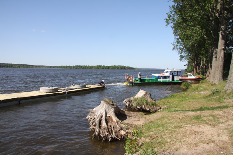
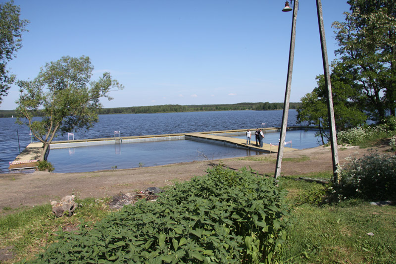
Due to its flood protection function, Sulejów Lake is characterised by a varied level of damming determined by hydrological events in the Pilica basin, which results in water level fluctuations. The fluctuations observed in the Reservoir cause baring of the bay’s banks, which additionally are vulnerable to strong erosion caused by waving thus prevent ecotone vegetation development. Currently, the bay is an estuary for waters discharged from a small basin – runoff has been observed during spring snow-melt season and intensive and long-term precipitation.
Plant Communities
Specific tall-herb communities have been identified within the stream valley, which develop within the shoreline of minor streams and reservoirs. These communities usually grow in small and narrow patches 1 to 2 metres wide. These sites are permanently wet, although flooded only periodically, which is also reflected in the valley of the study stream. Such communities are characterised by floral instability and dominance of various species in individual patches.
A phytosociological photo taken indicates that apart from Calystegia sepium, the study community also includes such species as Epilobium hirsutum. Riparian tall-herb fringe species (Calystegia sepium) and nitrofile (Urtica dioica, Solanum, Polygonum and Bidens) species have also been identified in this community. Due to strong waving, the bay area is free of any vegetation. Phalaridetum arundinaceae has overgrown some sections of the reservoir bay shoreline. Presence of large quantities of this species which is resistant to varied hydrological conditions due to the presence of micoryses, confirms varied ground water level and flooding observed in this area. Nitrofile species, such as Urtica dioica, riparian tall-herb fringe species of Convovuletalia setum order, (e.g. Calystegia sepium, which is a characteristic species growing in transition zones, i.e. ecotones ) also grow in this site.
Moving away from the reservoir, a developed meadow characterised by rich and compact turf and a relatively rich variety of species, is found. Phytocenosis found in this area is characterised by species that prefer humid conditions: Poa trivialis, Ranunculus arcis and Carex hirta. Co-occuring species include Ranunculus repens and Agrostis stolonifera, which represent the species growing in wetland habitats that are flooded periodically.
In the land section of the bay, recession of marshy plant communities being replaced by the species preferring lower water level, such as Poa pratensis, and meadow species resistant to treading down and grazing, such as s Achillea millefolium, Potentilla anserina and Flos Trifolii albi have been observed.
Characteristics of soil and bottom sediments
Analysis of the soil reaction results enables to classify the soil samples collected in the stream valley as:
- Acid soils (reaction below 6.8) at the sites found near Z5 (6.46),
- Neutral soils (reaction 6.9 – 7.2) near Z3 (6.93),
- Alkaline soils (reaction above 7.2) near Z4 (7.46).
Evaluation of contents of assimilable phosphorus (0.008 – 0.014 mg/kg of dry mass) and potassium (19.26 – 19.72 mg/kg of dry mass) in the soil has indicated that the soil is very poor (5th contents class). Similar finding has been established for nitrogen (N-NO3: 14.34 – 15.49 mg/kg of dry mass; N-NH4: 8.67 – 14.11 mg/kg of dry mass), which indicates low productive soil.
Considering organic matter contents in the valley’s bottom sediments, its accumulation has been reported at the stream estuary. The organic matter contents in samples collected in the central stretch of the stream during the season ranged between 0.61% - 3.61%, however in the samples collected at the estuary, between 5.86% - 9.04%,.
Samples of bottom sediments in Sulejów Reservoir are of mineral nature. Organic matter contents ranged between 1.42%, - 1.64%.
Reaction of the bottom sediments collected in the flood section of the bay (at the level of “Fregata” Bar) indicates that they are acid in nature (6.43) while the ones found near the stream estuary indicate alkaline reaction (7.37 – 7.85).
Proposed Project Solutions
Use of vegetation ecotonic zones is proposed under this project in order to improve quality of Sulejów Reservoir bay water. Ecotone, i.e. a buffer zone between land and water is one of the key tools which efficiently reduce diffused pollution through such processes as transformation of nutrients into plant biomass and reduction of nutrient re-circulation in the ecosystem. Plants retain from 10 to 50% of nutrient elements, majority of which is absorbed in the course of intensive growth period. The rest of the nutrients are chemically and physically bound by other ecosystem components, e.g. in the soil surface layer. That is why even following the end of vegetation season, thanks to the connections among biogeochemical processes, the processes that improve water quality occur.
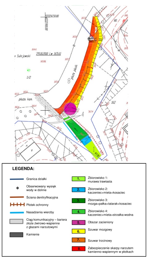
It is proposed that the ecotonic zone within Zarzęcin demo site should be composed of 2 elements:
- Plantings within the periodical stream valley area which are to reduce pollution entering the reservoir through surface runoff as well as to reduce concentration of nutrients in seepage water;
- Plantings within the bay area which are to reduce pollution entering the bay with stream water and surface runoff from the areas adjacent to the bay; these plantings will also contribute to reduction of pollution entering the bay through groundwater seepage below the reservoir shoreline (observed during low head of water in the reservoir)
Due to the low concentration of phosphates recorded in ground water and its seepage, it has also been proposed to implement a biogeochemical barrier in order to reduce phosphorus accessibility through its absorption. In order to reduce nitrogen compounds, installation of denitrification wall has also been proposed to intensify denitrification process which is an important process of removing nitrogen from ecosystem.
Water Equipment Planned
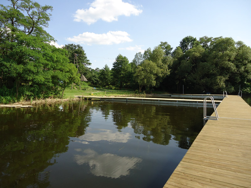
An approximately 100 metres long floating platform is planned for construction in Zarzęcin demo site. The mooring platform will secure the ecotone with plantings of specifically selected plant species. The platform connected with the shoreline will act as a breakwater to protect the ecotone against abrasion and vegetation damage. Edge platforms will be supported by a steep scarp leading to a footpath.
Platform will be made of segments constructed on the base of a steel framework filled with displacement elements made of expanded polystyrene. Its foundation will be constructed with pressure-impregnated 32 milimetre thick pine boards that will be screwed on timber girders based on steel ledger boards. For user safety reasons, 4 ladders for climbing out of the water will be fixed to the platform.
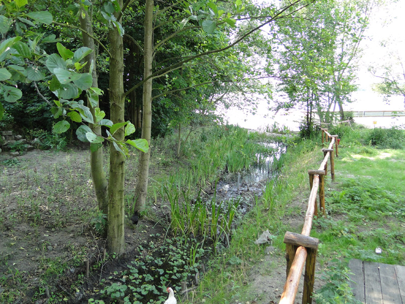
Borderline of the plot, Seepage observed in the valley, Denitrification wall, Protective fence, Willow plantings, Transport route – barrier gravel and lime deposit with erratic blocks, stones, Community 1:Grassy sward, Community 2: Caltha palustris + Mentha L. + Iris L., Community 3: Phalaris arundinacea L.+ Typha L. + Acorus calamus L. + Iris L., Community 4: Caltha palustris + Mentha L.+Sagittaria sagittifolia L.,Shady area, Phalaridetum arundinaceae, Scarp will be secured with a stone and lime layer in the fencing, Phragmitetum australis.


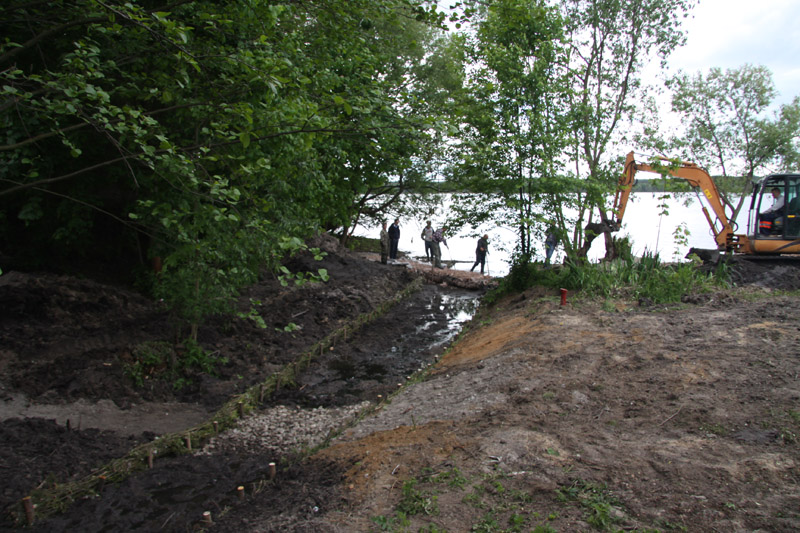
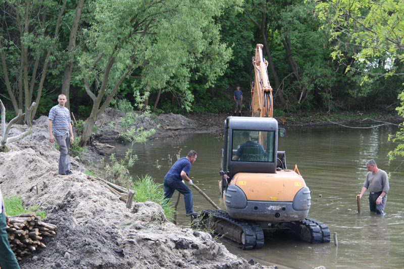
Earth Works
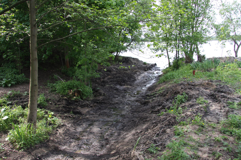
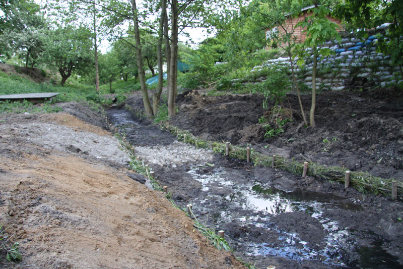
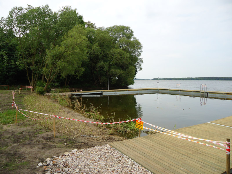
Between April and June 2012, works to develop the ecotonic zone in demo site in Zarzęcin to reduce pollution entering the bay with the water of a seasonal inflow (storm water), surface run-off from the areas adjacent to the bay, as well as to reduce concentration of nutrient compounds in water seepages appearing in the valley of the stream and along the coastal line, were performed.
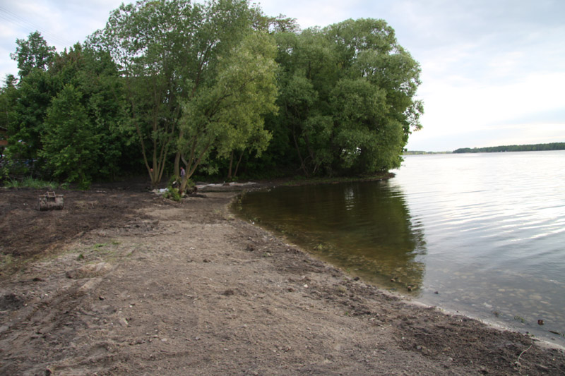
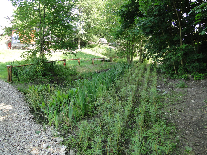
The ecotonic zone in Zarzęcin demo site covers the valley of a periodical stream and the bay’s coastal line. The total space area of this zone covers 675 sq.m.
The following work for the periodical stream was performed:
- Shaping the stream valley by desludging it and removing ruderal vegetation, followed by development of a fascine;
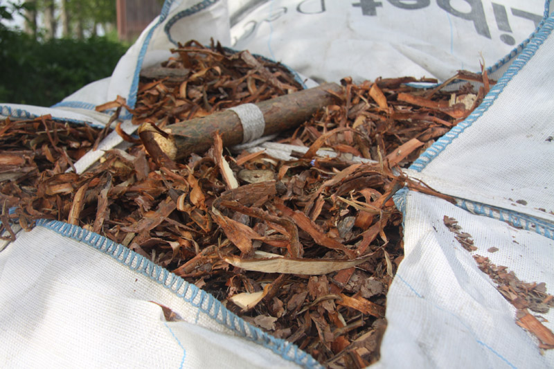
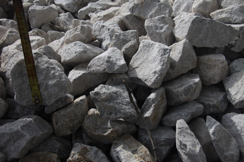
- The denitrification wall was constructed through digging up an approx. 1 m wide and approx. 1 m deep ditch, perpendicularly to the direction of seepage water and shallow ground water flow. The ditch was filled with a mixture of sand and pine sawdust, which through its gradual decomposition would provide denitrification bacteria with organic source of carbon. Nitrates present in water flowing through the wall would undergo denitrification to gaseous forms. Upon the work completion, the structure was protected against washout caused by storm water by using limestone embankment placed on non-woven geotextile fabric.
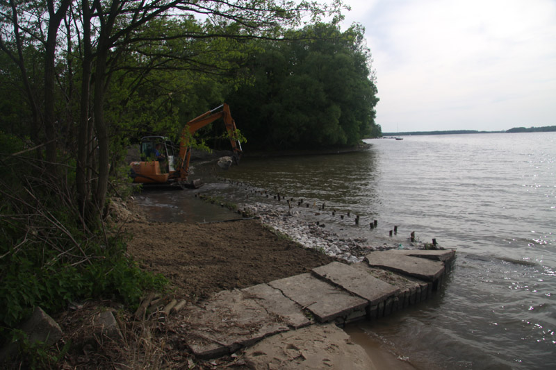
- In the estuary stretch, at the level of the “wild path”, a biogeochemical barrier was constructed. The barrier operations are based on the process of precipitation of phosphorus from calcium ions, and formulation of insoluble calcium phosphates. The barrier will reduce concentration of the phosphates in ground water by absorbing them, which will significantly strengthen this process. Passage for pedestrians based on rock gabions was provided on the barrier.
- Plantings were performed both on the valley scarps and in its corridor. In the course of the work focused on shaping the valley, a permanent seepage resulting from deepening of the valley was observed, which would contribute to maintaining swamp vegetation in the stream corridor, as well as Phragmites australis (the estuary section of the stream). Vegetation growing in the stream is to treat polluted seepage water as well as enhance treatment of storm water (performing the function of a biofilter) to ensure that such water does not directly enter the Reservoir. Willow and species characteristic for Phalaridetum arundinaceae and Glycerietum maximae were planted along the stream.
The following work was performed in the bay area:
- Restoration of the coastal line by forming and securing the washed out scarp achieved by fascine fences;
- In order to enhance treatment of seepage water, fascine fences were filled with lime and dolomite rock, which on the one hand would absorb dissolved phosphates, and protect the scarp against the washout on the other;
- Planting of Phalaris arundinacea L. and Phragmites australis is planned in the areas reaching the fascine fences.
The work of constructing the ecotonic zone in Zarzęcin demo site was completed in the early June. Construction of a floating platform was one of the final stages of the work. The platform is composed of floating modules with the dimension 12 x 2.4 metre, 3 ladders to provide connection with the shore and 6 anchors to which it is fastened.