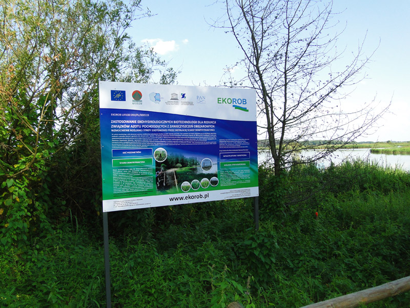
Barkowice Zatoka Demo Site
Charakterystyka obszaru
Optimisation of the existing and degraded ecotones in the reservoir bay vulnerable to diffuse pollution coming from agricultural and residential areas.

| Owner | 1/1 STATE TREASURY; Managing Authority: RBWM in Warsaw |
| Plot No | 1482/4 |
| Voivodship | łódzkie |
| District | piotrkowski |
| Municipality | Sulejów – Rural area |
| Village | Barkowice |
| Cadastral Unit | 101009_5, Sulejów – rural area |
| Section | Nr 0002, Barkowice |
General Characteristics
Barkowice demo site is located in an eroded fluvioglacial plain. At present, fluvial processes of the Pilica water (including seasonal fluctuations in the water level and fluctuations related with dam management) mainly impact land formation. Human activity aiming to increase the so-called tidal zone (beach) – digging the scarps and lifting land (reducing tidal zone – beach) in other locations, to increase land surface that potentially may be used for investments, is another key land formation element.
Geological Structure
For the area of Barkowice demo site, the Detailed Geological Map of Poland, Sulejów Sheet, scale 1 : 50 000, documents presence of lower fluvioglacial sands and gravels originating in the Central Poland’s glaciation. In the course of installation of the piezometer network, detailed data concerning this area’s geological structure was gathered (Annex1: Map of the piezometer network location). Barkowice demo site is mainly composed of Pleistocene sands of various grain composition and lower fluvioglacial gravels originating from Mazowieckie Interglacial. Small patches are covered with the youngest sediments, i.e. silts, originating from the Pilica’s accumulative activity. They were confirmed only at B7 (Barkowice Łąka).
The sites which are located morphologically higher (i.e. in B1 and B5), in the upper sections of the profiles, above the soil accumulation levels (organic-mineral levels), are characterised by a thin layer (0.5-0.6 m) of loamy sands or dusty sands which constitute the levels of soils that have been genetically formed in this site.
Hydrological Conditions
In Barkowice demo site, the first groundwater table has been found at the depth of 0.35-1.60 metres below the ground level (i.e. 166.12 – 166.27 metres above sea level). The water table is free in nature. Aquifer is formed of sands of various grain composition (fine, medium and coarse). The study groundwater has full hydraulic connection with Sulejów Reservoir waters. The developed map of hydroizohips as well as the hydrogeological cross-sections (C-C’, D-D’ and E-E’) indicate that water flows from west to east. Sulejów Reservoir is the main drainage base level. The D-D’ hydrological cross-section developed indicates that locally, among the individual piezometers, minor corrections in the water discharge direction may take place, which however does not affect the main eastern direction of discharge. Aquifer is mainly fed by atmospheric precipitation, and water level fluctuations depend on the volume of precipitation (both rain and snow) and Sulejów Reservoir damming level. The material compiled has indicated that the water level fluctuations in the reservoir will affect the first groundwater table. Results of laboratory tests concerning the value of filtration co-efficient (indicate that infiltrated aquifers are characterised by good filtration parameters.


Diagnoza zagrożeń
Chemical Characteristics of the Water in the First Aquifer
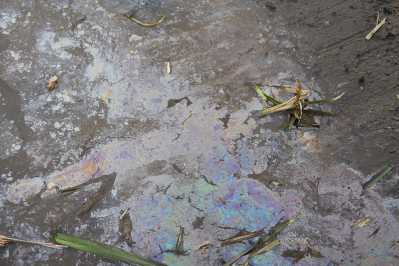
It has been reported that groundwater in Barkowice Zatoka demo site is contaminated with nitrogen compounds. The highest values of nitrates have been recorded at B4 and they ranged from 194 to 237 mg NO3/l. In the remaining monitoring stations situated in the first line below the fault of the scarp (i.e. B1 and B5) lower concentrations have been recorded, however they also exceeded 100 mg NO3/l. Increased values of phosphates in the groundwater ranging from 0.17 to 0.52 mg PO4/l. have also been recorded at these stations. Illegal discharge of household sewage directly into the soil or through leaky cesspits should be perceived as a source of nitrogen-related pollution. At the monitoring stations (at B15 and B14 piezometers) located in the second line below the fault of the scarp, in the ecotones, it has been recorded that concentrations of both nitrates and phosphates have been lower during vegetation season. A minor difference among the piezometers in the individual transects perpendicular to the reservoir shoreline has been reported following freezing of the ground.
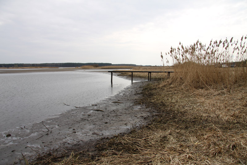
Characteristics of Surface Water in Sulejów Reservoir Bay
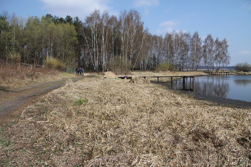
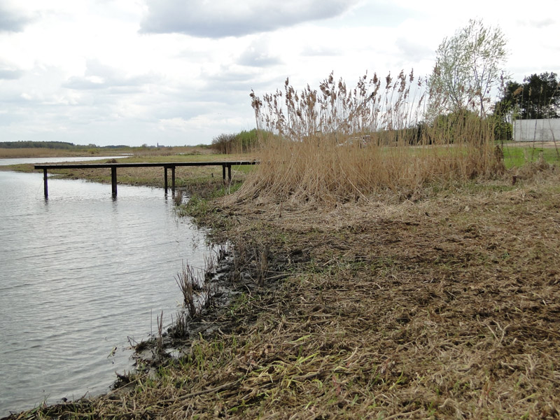
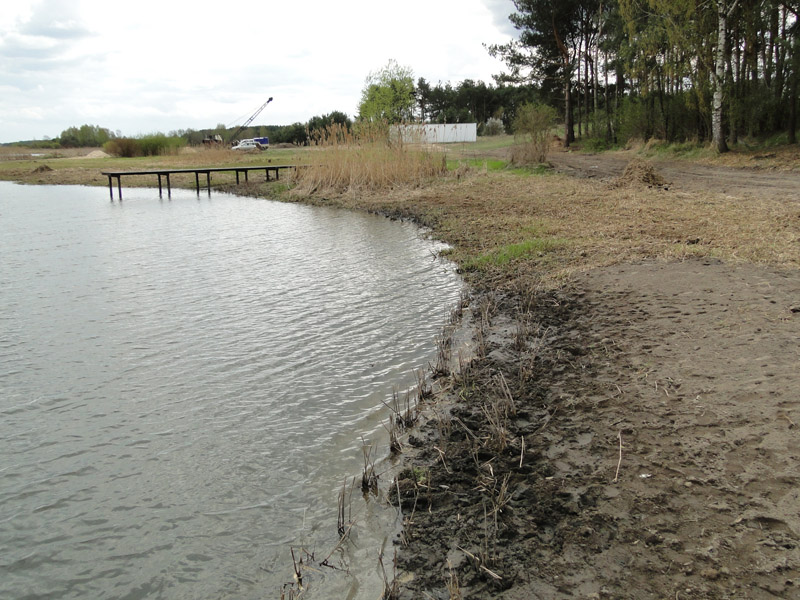
The bay within Barkowice Zatoka demo site is shallow, and its depth depends on the reservoir damming level. At the level of 166.60 metres above sea level, the average depth in the bay reaches approx. 0.5 metre. Bay waters were characterised with parameters similar to the parameters for the waters in Sulejów Reservoir pelagial. Phosphate concentration ranged from 0.02 to 0.16 mg PO4/l while nitrate concentration from 1.9 to 9.3 mg NO3/l.
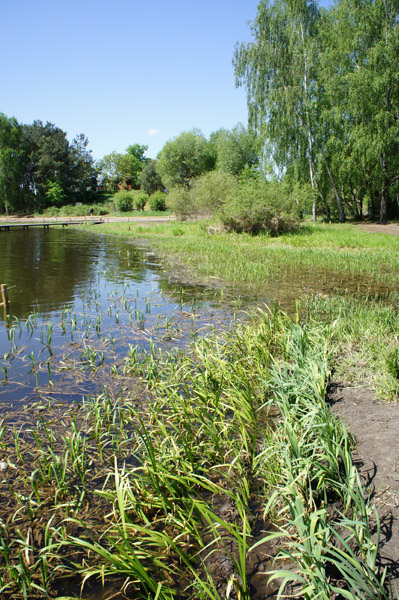
Plant Communities
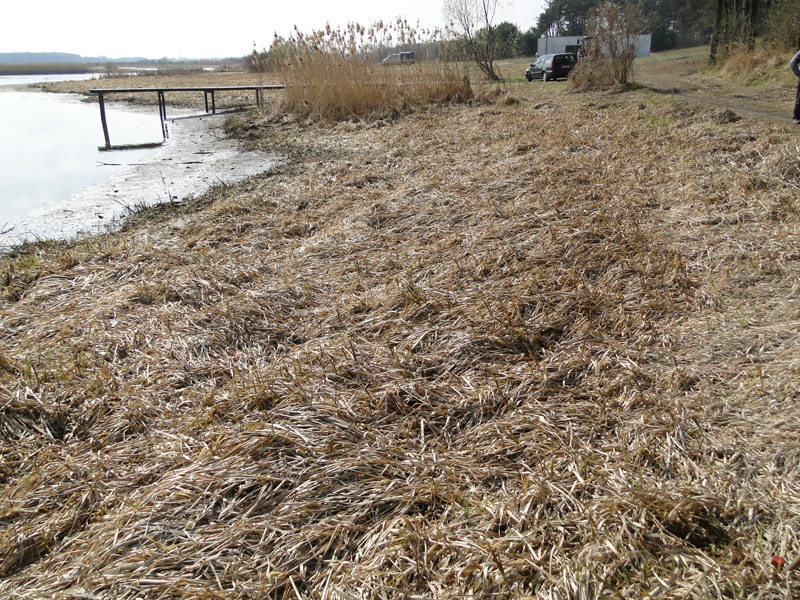
Plant communities characteristic for Barkowice Zatoka demo site include: Glycerietum maximae, Phalaridetum arundinaceae, Phragmitetum communis and willow shrubs.
Characteristics of Soil and Bottom Sediment
Analysis of the soil reaction results enables to classify the soil samples collected near pier No. 2 as neutral (7.14 – 7.17 ) during spring season, and slightly acid (6.31) during summer. Soil in the sites near piezometers at B5 – 4.23 and B4 – 5.69 have been classified as heavily acid, while the sample collected at B3 – 7.36 has been classified as alkaline.
Evaluation of assimilable phosphorus (0.011 mg/kg of dry mass) and potassium (28.59 mg/kg of dry mass) contents in the soil has indicated that the soil is very poor (5th class of productivity). Similar finding has been made for nitrogen (N-NO3: 3.69 mg/kg of dry mass; N-NH4: 8.61 mg/kg of dry mass), whose contents indicates low productivity soil.
Bottom sediments collected in the bay are mineral. The highest contents of organic matter has been observed in late autumn (3.73%), and a smaller contents in July (0.67%). Samples collected in spring contained 1.32% of organic matter. This time-related distribution may be due to accumulation of dead plant tissues in autumn followed by its slow decomposition in spring, and total decomposition into mineral forms in summer. Reaction of bottom sediments collected from the bay is alkaline (7.52 – 7.69).
Proposed Project Solutions
Proposed Project Solutions
Due to a very high contents of nitrates in the groundwater it is necessary to implement measures to reduce them. It has been proposed that operation of the ecotone vegetation should be supported by a denitrification wall. Denitrification walls are used to intensify denitrification processes which are natural processes occurring in shoreline ecotones. Denitrification is a key microbiological stage in nitrogen circulation, which mainly takes part in the sediment where gaseous form of nitrogen is released into atmosphere, which removes significant quantities of nitrogen from ecosystem. Such walls operate by filling the ditches transporting nitrogen-polluted groundwater with slowly degrading particles of organic carbon (usually in the form of sawdust), which provides the source of carbon for heterotrophic denitrifying bacteria.
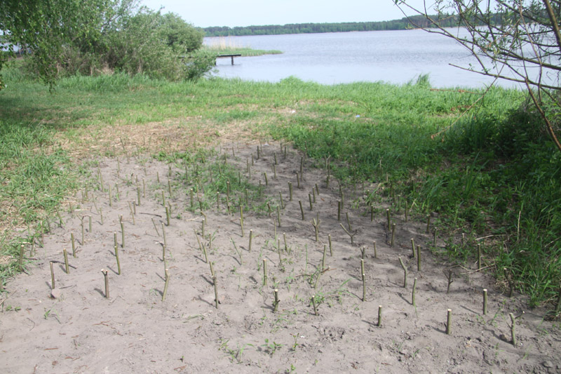
In the plant section of the ecotones, it is proposed that the existing vegetation, including a layer of soil and sediment, should be removed and replaced with plantings similar to the ones growing in the existing communities. Plants at the climax stage are proposed to be replaced by plants at the initial succession stage. It is of importance as periods of release and accumulation of nutrients may be related to the successive development stages (Pinay et al.,1990). The initial matter retention capacity stabilises with time and then it passes into equilibrium state between accumulation and release (climax phase) (Zimka 1989). Subsequently, as a result of matter saturation, its release may commence. The highest matter retention is observed in the ecotones in the early succession stages (Zalewski, 1994).
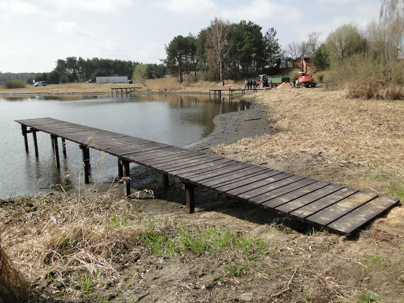
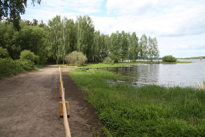
Water Equipment Planned
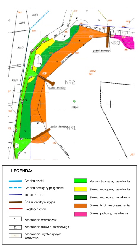
Construction of water equipment in Barkowice Zatoka demo site will be carried out in two stages:
- Stage One: two piers in bad technical condition will be deconstructed
- Stage Two: 3 mooring piers will be constructed. Two of them will be in the form of a rectangular platform with the dimensions reaching 1.5 x 15.0 metres. The third one will be a T-shape pier with the dimensions of the main deck reaching 1.5 x 12.0 metres and head-section 1.5 x 3.0 metres.
Piers will secure the ecotonic zone with plantings of specifically selected plant species. Pier structures connected with the shoreline will act as a breakwater to protect the ecotone against abrasion and vegetation damage as well as they will provide recreational and view-related function to operate as a harbour for surfers, canoeists, sailors and anglers. Piers will consist of a frame made of timber pillars with the dimensions of 10 x 10cm fixed in the stream-bed, a spar with the dimensions 10 x 10cm and a deck built of 32 mm thick panels made of hard timber. Vessels will moor to the beams in the pier.
Plot borderline, Borderline between demo sites166.60 N.P.P. ??, Denitrification wall, Protective fence, Behaviour of willow shrubs, Behaviour of Phragmitetum australis, Behaviour of the local communities, Grassy sward; Plantings, Phalaridetum arundinaceae; Plantings, Glycerietum maximae; Plantings, Phragmitetum australis; Plantings, Typhetum latifoliae; Plantings.
Earth Works
Earth Works
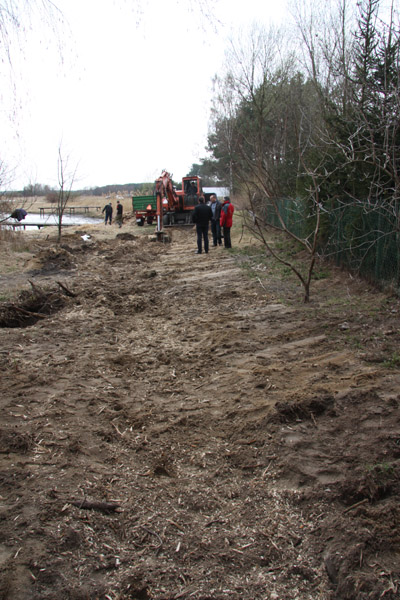
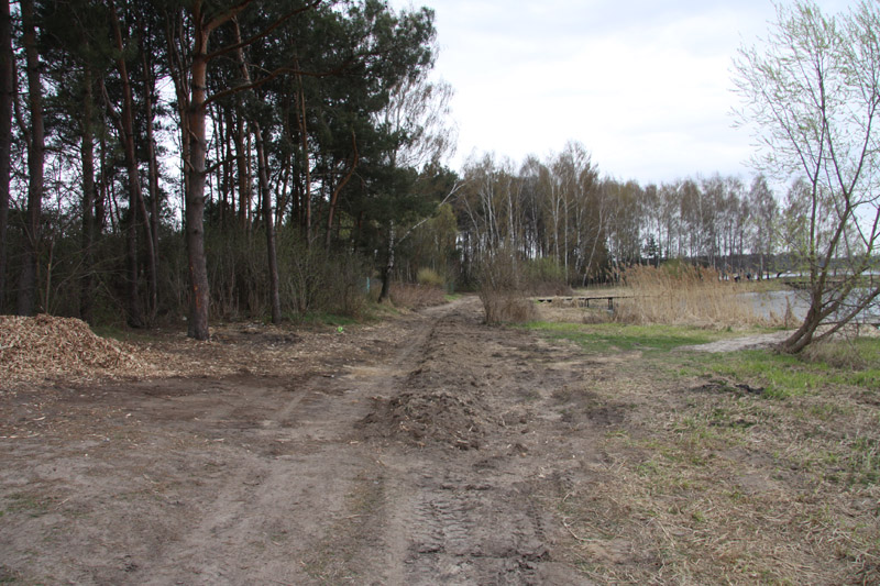
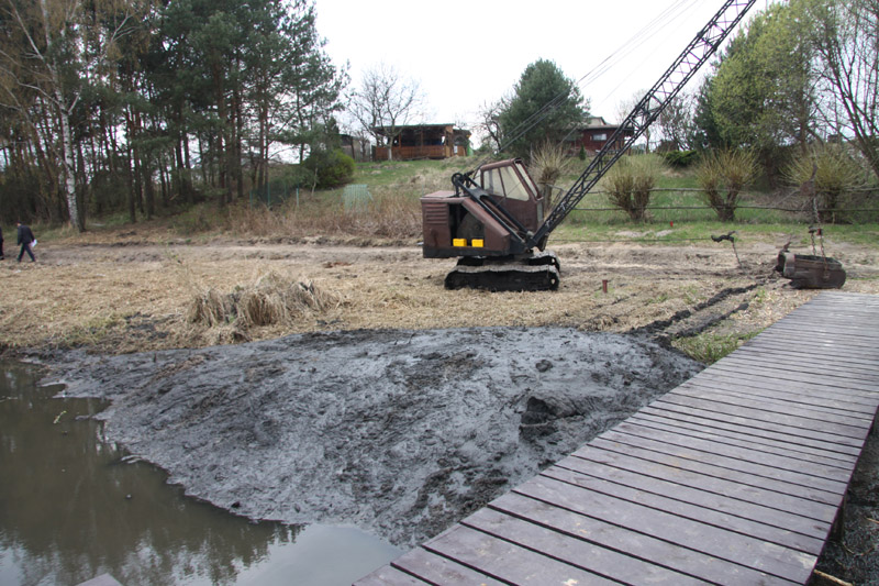
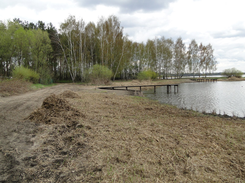
Between April and May 2012, works to construct ecotonic zones in the demo sites in the vicinity of Barkowice on Sulejow Reservoirs to reduce diffuse pollution entering the reservoir and optimise the ecotonic zones vulnerable to strong pressures caused by tourists, were performed.
The following work was performed in the BARKOWICE ZATOKA demo site:
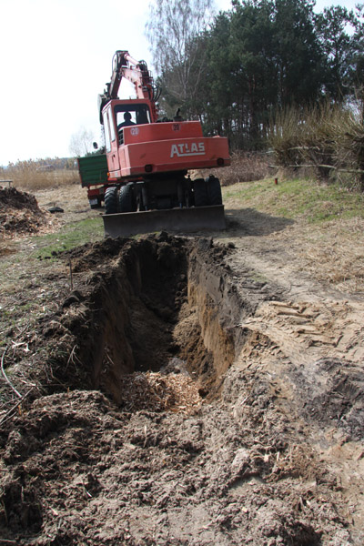
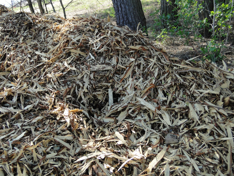
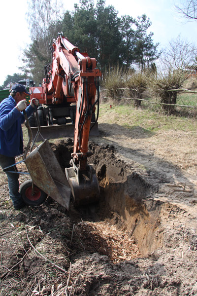
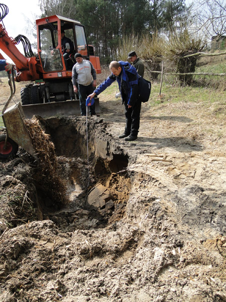
- Construction of a denitrification wall to strengthen the vegetation buffer zone was the key element. This denitrification wall was constructed through digging up an approx. 1 m wide and approx. 100 m long ditch reaching the maximum depth ranging between 1.5-1.7 m, perpendicularly to the direction of ground water flow. The wall was constructed within the axis of the current transport route running along the bay coastal zone, and upon the work completion, the structure was out of sight. Soil from the ditch was mixed with pine sawdust, which through its gradual decomposition, would provide denitrification bacteria with organic source of carbon. Nitrates present in water flowing through the wall would undergo denitrification to gaseous forms. Based on the pilot data obtained, the anticipated efficiency of the wall in reducing nitrates should reach approx. 80%.
- Some of bottom sediments and layers of soil were removed in the sites indicating significant pollution. Then some plantings based on the existing communities were performed in order to maintain the variety of species and biodiversity developed as a result of the process of succession. The following species were planted: Phalaridetum arundinaceae, Glycerietum maximae, Phragmitetum communis and Carectum, papyrio Vulg.
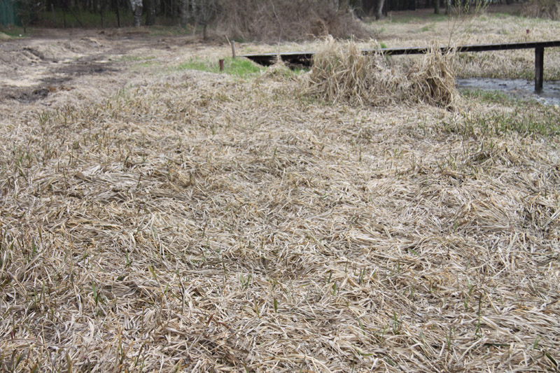
- Cleaning procedures were implemented in the vegetation part of the ecotonic zone to mow dead parts of the coastal zone vegetation.
- Fences preventing vegetation from being treaded on were made.